Fire Hazard Zone Maps Put Focus on Torrance Preparedness |
A small portion of Torrance is included in California’s updated fire hazard severity mapping. |
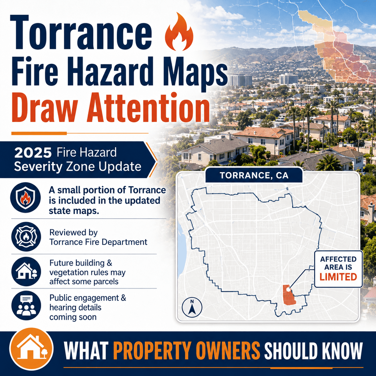 |
A small portion of Torrance has been included in California’s updated Fire Hazard Severity Zone mapping, bringing new attention to local fire preparedness and future property requirements.
According to the city’s Trending in Torrance page, CAL FIRE and the Office of the State Fire Marshal began rolling out the 2025 Recommended Fire Hazard Severity Zone maps for Local Responsibility Areas across California. These maps classify land within local jurisdictions as moderate, high, or very high fire hazard severity zones based on data such as fuels, fire history, weather, terrain, and other factors.
The City of Torrance says the Torrance Fire Department has reviewed the updated map and identified an area where parcels will be affected. The city also says future building and vegetation management requirements are anticipated as a result.
For residents, the most important point is not panic — it is awareness. Fire hazard mapping can affect future property rules, vegetation management expectations, building requirements, and insurance-related questions for affected areas.
The city says additional community engagement efforts will focus on neighborhoods impacted by the changes, and public hearing details are expected to be posted online when available.
Article Link: https://www.trendingintorrance.com/fire-hazard-severity-zones.html
Check the Fire Hazard Zone Update |