Why Do Old Torrance’s Streets Form a Giant “Y”? |
The neighborhood’s unusual angles are surviving pieces of an ambitious 1912 plan for a modern city where homes, businesses, industry, railroads, and green space could coexist. |
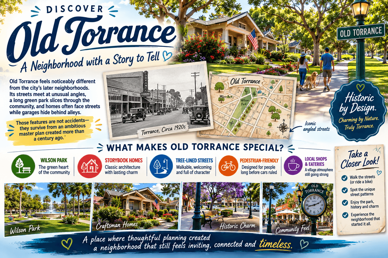
Drive through Old Torrance and the street pattern can feel slightly puzzling.
Torrance Boulevard crosses the neighborhood diagonally. Cabrillo Avenue approaches from another direction. El Prado stretches through the residential area like a long green spine. Smaller streets branch and intersect at angles instead of following the conventional north-south and east-west grid found across much of Southern California.
The explanation dates to Torrance’s founding.
In 1911, developer Jared Sidney Torrance and the Dominguez Land Company purchased approximately 3,000 acres of the former Rancho San Pedro. Their goal was not simply to subdivide land. They envisioned a carefully planned industrial city where factories, businesses, transportation, homes, parks, and civic life would function together.
To design the community, the developers hired the nationally renowned Olmsted Brothers landscape-architecture firm. Frederick Law Olmsted Jr., whose father helped design New York’s Central Park, played the principal role in shaping Torrance’s original plan.
A City Divided Into Three Parts
The plan organized Torrance into three distinct districts.
The industrial area was placed primarily to the north and east. The residential district was positioned to the west. Between them sat a commercial center near the Pacific Electric Railway Depot—the area now recognized as Downtown or Old Torrance.
This arrangement was intended to create a balanced community rather than an uncontrolled factory town. Workers could live near employment, businesses could gather around transportation, and residential streets could remain physically separated from the heaviest industrial activity.
The downtown business district occupied a triangular area bordered by Torrance Boulevard, Cabrillo Avenue, and Cravens Avenue. It sat near the meeting point of the residential, commercial, industrial, and railroad portions of the plan.
That triangle is one reason downtown Torrance still feels unlike a conventional rectangular business district.
The Meaning Behind the “Y”
The original residential layout was organized around a broad Y-shaped pattern defined largely by Torrance Boulevard and Cabrillo Avenue.
The commercial district sat near the junction of the Y, while residential streets and El Prado extended outward from it. Railroad tracks added more diagonal lines, physical barriers, and irregularly shaped parcels throughout the tract.
The design reflected ideas associated with the early-20th-century garden city movement. That movement attempted to combine the economic opportunity of an industrial city with the open space, greenery, order, and healthier living conditions associated with smaller communities.
The Olmsted plan deliberately incorporated El Prado as a landscaped central corridor. The park was placed at an angle that directs the eye toward distant mountains, making the landscape itself part of the neighborhood’s visual design.
Historical accounts also connect the street orientation with natural ventilation and prevailing ocean breezes. The larger goal was clear: the streets and parks were being shaped around environmental conditions and human experience, not merely divided into the easiest possible building lots.
Why So Many Alleys?
The Y is not the only surviving clue.
Many Old Torrance blocks contain broad residential streets in front and narrow service alleys behind the homes. Garages, utilities, electrical lines, and later secondary units were generally placed toward the rear of the lots and accessed from those alleys.
That arrangement reduced the number of driveways interrupting sidewalks and front yards. It also allowed houses to maintain more consistent setbacks and created a repeating rhythm of homes, sidewalks, planting strips, and open frontages.
In other words, the alleys were not leftover spaces. They were part of the original circulation and neighborhood-design system.
Residents can still see this pattern today: homes present their porches and façades toward the street, while many of the practical functions of daily life remain tucked behind them.
Why Wasn’t the Entire Plan Completed Immediately?
Although Torrance was founded in 1912, the original plan was not built all at once.
World War I, economic recession, changing business conditions, and periods of slower development delayed portions of the project. The Olmsted plan unfolded gradually over roughly 30 years.
When Torrance incorporated in 1921, parts of the promised infrastructure and original development remained unfinished. The discovery of petroleum and the economic growth of the 1920s then generated another wave of construction, filling in more of the residential Y.
By the end of World War II, much of the residential Torrance Tract had been developed. Later suburban expansion spread far beyond the original community, producing the larger, more conventional street grids familiar across the rest of modern Torrance.
The Olmsted Tract Today
The surviving planned area is commonly called the Torrance Tract or Olmsted Tract.
It covers approximately 109 city blocks and contains residential, commercial, and historically industrial areas. The broader tract is generally bounded by Dominguez Street, Western Avenue, Plaza Del Amo, and Crenshaw Boulevard.
The City recognizes several defining characteristics within the historic residential area:
These elements help explain why Old Torrance feels more intimate, walkable, and visually varied than many neighborhoods developed after World War II.
A Master Plan Still Hiding in Plain Sight
Old Torrance’s angled streets are sometimes treated as a charming inconvenience or navigational curiosity. In reality, they are evidence of one of Southern California’s early experiments in comprehensive city planning.
The Y-shaped pattern helped organize an entire community. It connected transportation and commerce, separated homes from heavy industry, created a prominent civic green space, and gave residential streets a distinctive structure.
More than a century later, many parts of that vision remain visible.
The next time Torrance Boulevard, Cabrillo Avenue, Cravens Avenue, or El Prado sends you traveling at an unexpected angle, remember: you are not navigating a planning mistake.
You are moving through the outline of the original city.
Article Link
|
0 Comments
Join the conversation
Be the first to comment
Share your thoughts above.