
Why Is Old Torrance Turned at an Angle? |
That Crooked-Looking Street Grid Wasn't a Mistake — It Was Part of the City's Original Design |
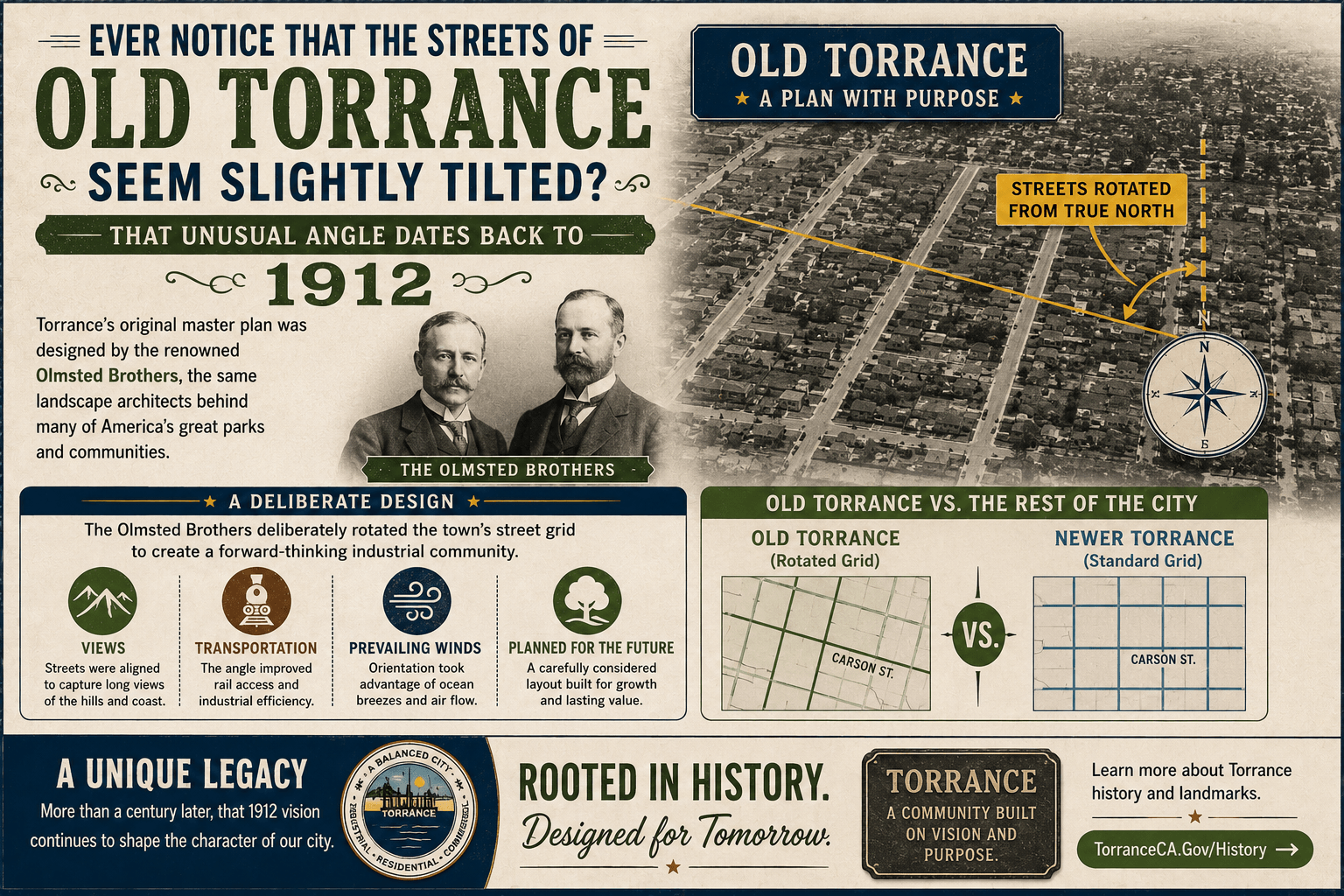
Pull up a map of Torrance and something unusual becomes obvious.
Most of the surrounding South Bay follows a fairly predictable north-south, east-west street grid.
Then you reach Old Torrance—and the entire neighborhood seems to turn.
That wasn't an accident.
It was part of the original plan for Torrance more than a century ago.
Torrance Was Designed Before It Was Built
When businessman Jared Sidney Torrance and his partners acquired roughly 3,500 acres of ranchland in the early 1900s, they weren't simply subdividing property.
They intended to build a new kind of community: a planned industrial city where factories, businesses, homes, parks and transportation would all work together.
To design it, the developers hired one of America's most prominent planning firms—the Olmsted Brothers.
The firm was led by John Charles Olmsted and Frederick Law Olmsted Jr., sons of famed landscape architect Frederick Law Olmsted, whose work included New York's Central Park.
The younger Olmsteds were major figures in American city planning in their own right, and Torrance became one of their California projects.
And That Explains the Angle
The Olmsted plan didn't simply lay streets on the conventional regional grid.
Instead, the designers created an axial street system that was deliberately rotated.
One reason was surprisingly scenic.
According to Torrance's historic planning documents, the central axis was positioned to take advantage of a view toward Mount San Antonio—better known as Mount Baldy—in the San Gabriel Mountains.
What looks today like a slightly crooked street network was therefore part of a much larger landscape design.
The original tract encompassed about 109 city blocks, with separate residential, commercial and industrial areas organized around a central landscaped green.
Even the Factories Were Carefully Positioned
The Olmsteds were also thinking about something far less picturesque than mountain views: factory pollution.
Industry was concentrated primarily on the eastern side of the original community.
Why?
Prevailing breezes generally moved from west to east, so placing industrial uses to the east helped carry smoke and pollution away from the residential neighborhoods rather than toward them.
For a city being planned around heavy industry in 1912, that was an unusually deliberate environmental consideration.
The Railroad Was the Center of Everything
Transportation was another major element of the design.
The original town radiated outward from the Pacific Electric Railway station, connecting Torrance with Los Angeles and the surrounding region.
The famous El Prado Bridge, designed by architect Irving Gill, marked the eastern gateway into the community, while the railway brought workers and goods directly into Torrance.
The combination of rail transportation, industry, commercial streets, housing and landscaped public space reflected what planners called the Garden City Movement—an international planning philosophy that attempted to combine the economic opportunities of cities with the beauty and open space of the countryside.
More Than 110 Years Later, You Can Still See the Plan
Torrance eventually expanded far beyond that original one-square-mile community.
New neighborhoods, shopping districts, freeways and major arterial streets grew around it.
But Old Torrance largely retained the orientation established by the Olmsted Brothers in 1912.
That's why streets such as El Prado, Sartori, Cabrillo and surrounding residential blocks seem to sit at an angle when viewed against the newer parts of Torrance.
You're not looking at a quirk created by later development. You're looking at the surviving outline of the original city plan.
More than a century later, every time you make one of those slightly angled turns through Old Torrance, you're essentially driving through a piece of a 1912 blueprint.
Article Link: Explore the History of Torrance's Original City Plan |
0 Comments
Join the conversation
Be the first to comment
Share your thoughts above.